
I offer a full range of visual impact assessment services, including lidar-based viewshed analysis (mapping), scenic resource inventory mapping, field photography and balloon testing, photo simulations, and comprehensive report writing. I'm able to scale to larger projects by teaming with several expert collaborating consultants. My visual assessment experience includes work on quarry expansions, cell towers, solar facilities, electric transmission lines and wind turbine generation facilities.
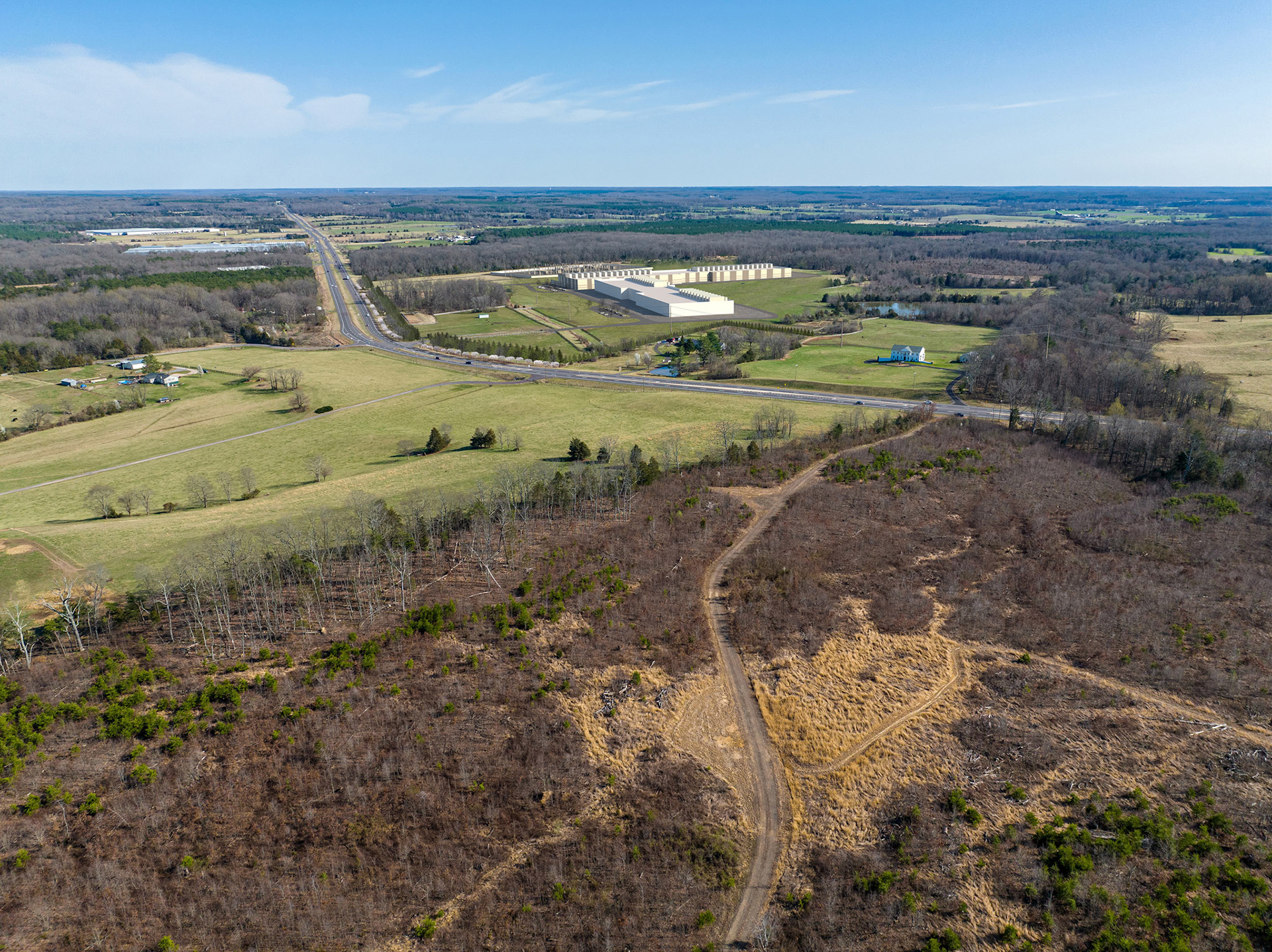
Data Center Photo Simulation
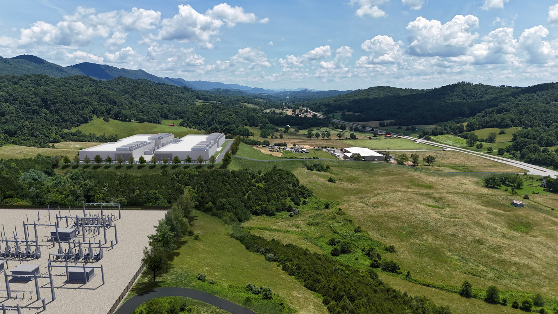
Data Center Photo Simulation
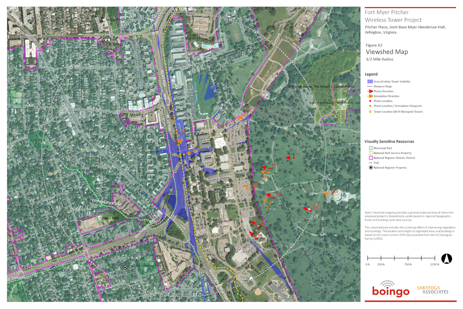
Cell Tower Viewshed Analysis Map
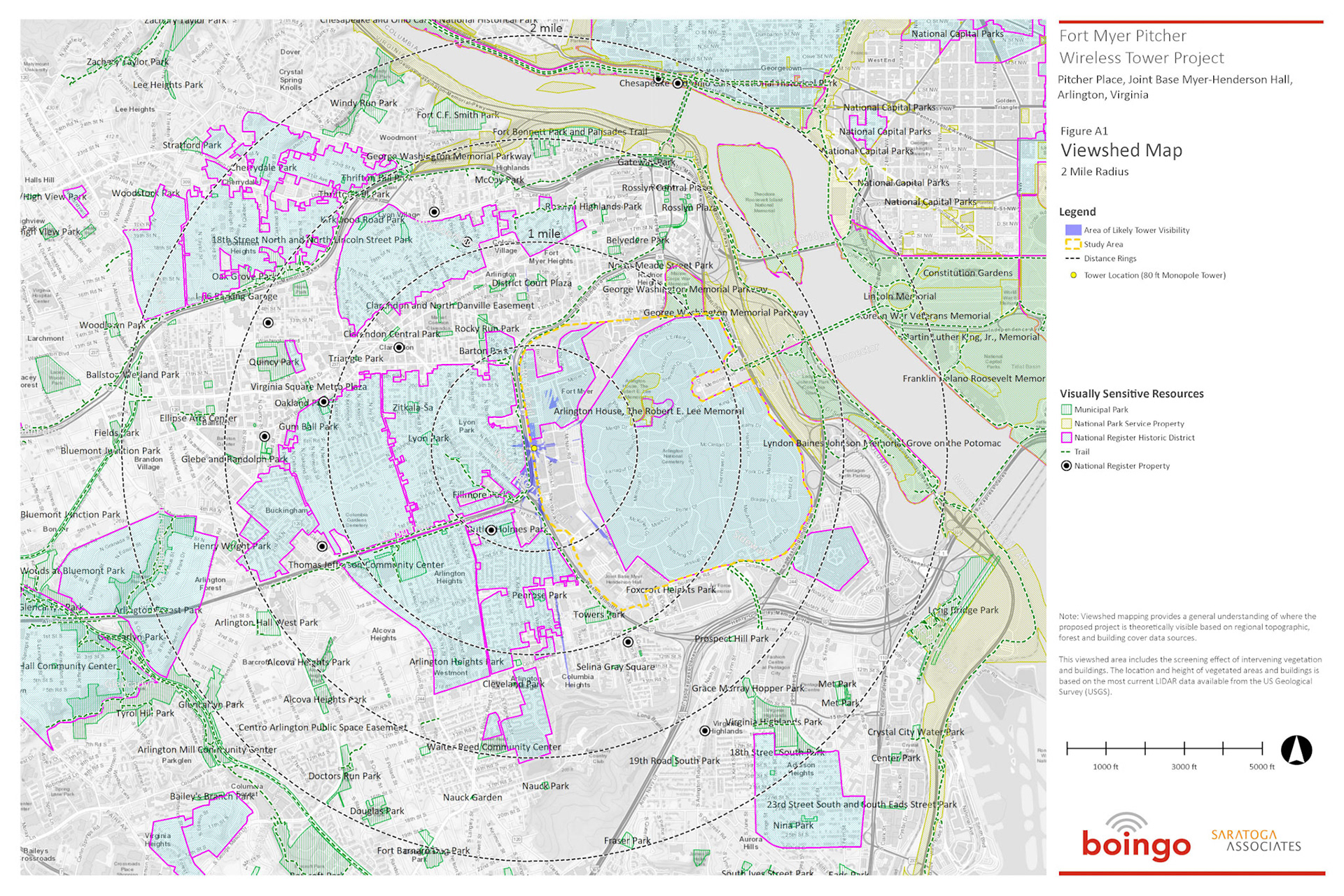
Cell Tower Viewshed Analysis Map